
Файл:Simeon DeWitt Otsego County NY c.1792.png
Оригинален файл (729 × 1044 пиксела, големина на файла: 431 КБ, MIME-тип: image/png)
| Този файл е от Общомедия и може да се използва от други проекти.
Следва информация за файла, достъпна през оригиналната му описателна страница. |
Резюме
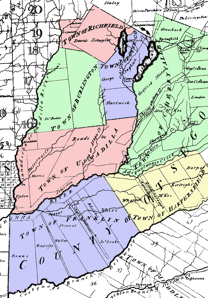
Map of Otsego County, New York c. 1792. Note that the county was larger than it is now, but with fewer towns. This was taken from a larger map by surveyor general Simeon De Witt and colored by me.
The county's towns at the time included:
- Burlington
- Cherry Valley
- Franklin (now a part of Delaware County, New York)
- Harpersfield (now a part of Delaware County, New York)
- Otsego
- Richfield
- Unadilla
Лицензиране
|
Това произведение е обществено достояние в държавите, в които срокът на авторското право е 70 години или по-малко след смъртта на автора.
| |
| This file has been identified as being free of known restrictions under copyright law, including all related and neighboring rights. | |
История на файла
Избирането на дата/час ще покаже как е изглеждал файлът към онзи момент.
| Дата/Час | Миникартинка | Размер | Потребител | Коментар | |
|---|---|---|---|---|---|
| текуща | 02:32, 19 юни 2006 | | 729 × 1044 (431 КБ) | Nonenmac | Map of Otsego County, New York c. 1792. Note that the county was larger than it is now, but with fewer towns. This was taken from a larger map by Simeon De Witt. The county's towns at the time included: *Burlington *[ |
Използване на файла
Следната страница използва следния файл:
Глобално използване на файл
Този файл се използва от следните други уикита:
- Употреба в ar.wikipedia.org
- Употреба в en.wikipedia.org
- Употреба в ja.wikipedia.org
- Употреба в la.wikipedia.org
- Употреба в nl.wikipedia.org
- Употреба в pt.wikipedia.org