
Файл:Simeon DeWitt Twenty Townships c.1792.png
Оригинален файл (960 × 907 пиксела, големина на файла: 487 КБ, MIME-тип: image/png)
| Този файл е от Общомедия и може да се използва от други проекти.
Следва информация за файла, достъпна през оригиналната му описателна страница. |
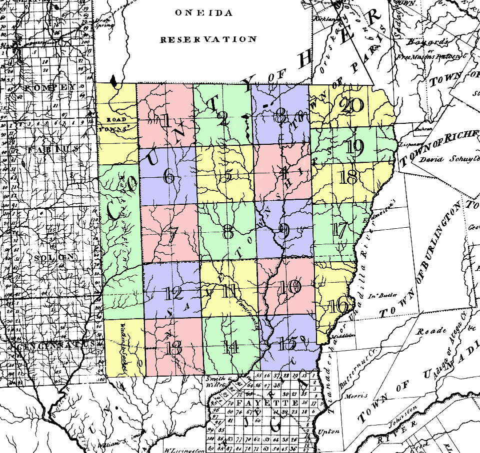
| Описание | Map of the Twenty Townships (called Sale Townships on this map). Located in what was then w:Herkimer County, New York, about where northern Chenango and southern Madison Counties are today. | ||||
| Дата | circa 1779 | ||||
| Източник | w:Image:Twenty Townships.png | ||||
| Автор | Simeon De Witt NY Surveyor General (colored by me) | ||||
| Права (Повторно използване на файла) |
|
||||
История на файла
Избирането на дата/час ще покаже как е изглеждал файлът към онзи момент.
| Дата/Час | Миникартинка | Размер | Потребител | Коментар | |
|---|---|---|---|---|---|
| текуща | 12:56, 19 юни 2006 | | 960 × 907 (487 КБ) | Nonenmac | {{Information |Description=Map of the '''''Twenty Townships''''' (called Sale Townships on this map). Located in what was then w:Herkimer County, New York, about where northern Chenango and southern [[w:Madison County, |
Използване на файла
Следната страница използва следния файл:
Глобално използване на файл
Този файл се използва от следните други уикита:
- Употреба в ar.wikipedia.org
- Употреба в en.wikipedia.org
- Употреба в ja.wikipedia.org
- Употреба в pt.wikipedia.org