
Файл:USACE New Orleans skyline.jpg

Размер на този преглед: 800 × 534 пиксела. Други разделителни способности: 320 × 214 пиксела | 640 × 428 пиксела | 1024 × 684 пиксела | 1500 × 1002 пиксела.
Оригинален файл (1500 × 1002 пиксела, големина на файла: 314 КБ, MIME-тип: image/jpeg)
| Този файл е от Общомедия и може да се използва от други проекти.
Следва информация за файла, достъпна през оригиналната му описателна страница. |
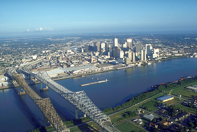
| Описание | Skyline of New Orleans, Louisiana, USA. The twin spans of the Crescent City Connection bridges are in the foreground. | |||
| Дата | ||||
| Източник |
U.S. Army Corp of Engineers Digital Visual Library Digital Visual Library home page Image page Image description page |
|||
| Автор | Michael Maples, U.S. Army Corps of Engineers | |||
| Права (Повторно използване на файла) |
|
|||
| други версии |
|

| Camera location | | View this and other nearby images on: OpenStreetMap |
|---|
История на файла
Избирането на дата/час ще покаже как е изглеждал файлът към онзи момент.
| Дата/Час | Миникартинка | Размер | Потребител | Коментар | |
|---|---|---|---|---|---|
| текуща | 03:55, 14 март 2007 | | 1500 × 1002 (314 КБ) | DanMS | {{Information | Description = Skyline of New Orleans, Louisiana, USA. | Source = U.S. Army Corp of Engineers Digital Visual Library<br />[http://images.usace.army.mil/Main.html Digital Visual Library home page]<br />[http://images.usace.army.mil/imag |
Използване на файла
Следната страница използва следния файл:
Глобално използване на файл
Този файл се използва от следните други уикита:
- Употреба в bn.wikipedia.org
- Употреба в de.wikipedia.org
- Употреба в en.wikipedia.org
- Употреба в es.wikipedia.org
- Употреба в es.wikinews.org
- Употреба в ext.wikipedia.org
- Употреба в fa.wikipedia.org
- Употреба в fr.wikipedia.org
- Употреба в it.wikiquote.org
- Употреба в it.wikivoyage.org
- Употреба в nl.wikipedia.org
- Употреба в zh.wikipedia.org