
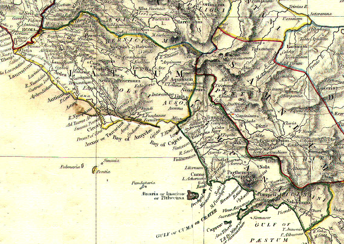
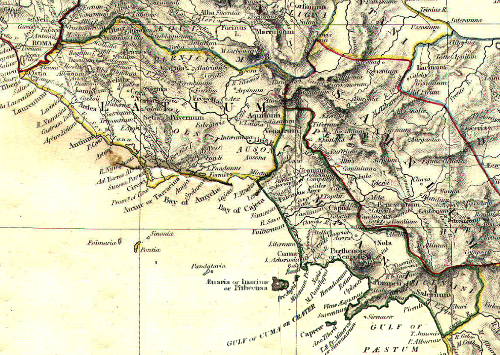
Файл:Latium et Campania.png
Оригинален файл (1158 × 822 пиксела, големина на файла: 7,38 МБ, MIME-тип: image/png)
| Този файл е от Общомедия и може да се използва от други проекти.
Следва информация за файла, достъпна през оригиналната му описателна страница. |
Резюме
| Описание | Reference map for Roman Empire Regium I Latium et Campania | ||||||||||||||||||||||
| Дата | |||||||||||||||||||||||
| Източник | The Historical Atlas by William R. Shepherd, 1911 | ||||||||||||||||||||||
| Автор |
|
||||||||||||||||||||||
| Права (Повторно използване на файла) |
public domain because its copyright has expired | ||||||||||||||||||||||
Лицензиране
|
Това произведение е обществено достояние в държавите, в които срокът на авторското право е 70 години или по-малко след смъртта на автора.
| |
| This file has been identified as being free of known restrictions under copyright law, including all related and neighboring rights. | |
История на файла
Избирането на дата/час ще покаже как е изглеждал файлът към онзи момент.
| Дата/Час | Миникартинка | Размер | Потребител | Коментар | |
|---|---|---|---|---|---|
| текуща | 12:06, 1 май 2008 | | 1158 × 822 (7,38 МБ) | GlióPanteco | {{Information |Description=Reference map for Roman Empire Regium I Latium et Campania |Source=''The Historical Atlas'' by William R. Shepherd, 1911 |Date=May 1st 2008 |Author=William R. Shepherd |Permission=public domain because its copyright has expired |
Използване на файла
Следната страница използва следния файл:
Глобално използване на файл
Този файл се използва от следните други уикита:
- Употреба в ar.wikipedia.org
- Употреба в da.wikipedia.org
- Употреба в en.wikipedia.org
- Употреба в es.wikipedia.org
- Употреба в et.wikipedia.org
- Употреба в fi.wikipedia.org
- Употреба в fr.wikipedia.org
- Употреба в id.wikipedia.org
- Употреба в it.wikipedia.org
- Napoli
- Sperlonga
- Calvi Risorta
- Alatri
- Anagni
- Aquino
- Arpino
- Atina
- Trevi nel Lazio
- Cori
- Priverno
- Sezze
- Castel Volturno
- Cales
- Ariccia
- Lanuvio
- Palestrina
- Velletri
- Cuma
- Atella (città antica)
- Capua (città antica)
- Roma (città antica)
- Gaeta
- Forum Appii
- Bovillae
- Oplontis
- Giugliano in Campania
- Terracina
- Nuceria Alfaterna
- Stabia
- Avella
- Vescia (città)
- Pentapoli aurunca
- Lavinio (città antica)
- Ceccano
- Crustumerium
- Miseno (Bacoli)
- Fondi
Преглед на глобалната употреба на файла.