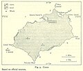
Файл:Map of Cocos from Pacific Islands, vol. 2 (Geographical Handbook Series, 1943).jpg
Map_of_Cocos_from_Pacific_Islands,_vol._2_(Geographical_Handbook_Series,_1943).jpg (646 × 555 пиксела, големина на файла: 77 КБ, MIME-тип: image/jpeg)
История на файла
Избирането на дата/час ще покаже как е изглеждал файлът към онзи момент.
| Дата/Час | Миникартинка | Размер | Потребител | Коментар | |
|---|---|---|---|---|---|
| текуща | 20:13, 12 октомври 2006 |  | 646 × 555 (77 КБ) | Ratzer | http://www.lib.utexas.edu/maps/historical/pacific_islands_1943_1945/cocos.jpg http://www.lib.utexas.edu/usage_statement.html?maps=yes: "Most of the maps scanned by the University of Texas Libraries and served from this web site are in the public domain. |
| 20:12, 12 октомври 2006 |  | 646 × 555 (77 КБ) | Ratzer | ||
| 20:09, 12 октомври 2006 |  | 646 × 555 (77 КБ) | Ratzer | http://www.lib.utexas.edu/maps/historical/pacific_islands_1943_1945/cocos.jpg http://www.lib.utexas.edu/usage_statement.html?maps=yes: "Most of the maps scanned by the University of Texas Libraries and served from this web site are in the public domain. |
Използване на файла
Следната страница използва следния файл:
Глобално използване на файл
Този файл се използва от следните други уикита:
- Употреба в az.wikipedia.org
- Употреба в ca.wikipedia.org
- Употреба в cs.wikipedia.org
- Употреба в de.wikipedia.org
- Употреба в el.wikipedia.org
- Употреба в en.wikipedia.org
- Употреба в en.wikivoyage.org
- Употреба в eo.wikipedia.org
- Употреба в es.wikipedia.org
- Употреба в fr.wikipedia.org
- Употреба в gl.wikipedia.org
- Употреба в he.wikipedia.org
- Употреба в hr.wikipedia.org
- Употреба в ja.wikipedia.org
- Употреба в nn.wikipedia.org
- Употреба в no.wikipedia.org
- Употреба в pl.wikipedia.org
- Употреба в ru.wikipedia.org
- Употреба в sh.wikipedia.org
- Употреба в uk.wikipedia.org
- Употреба в vi.wikipedia.org


