
Файл:California map showing counties (source).xcf

Оригинален файл (957 × 1107 пиксела, големина на файла: 363 КБ, MIME-тип: image/x-xcf)
| Този файл е от Общомедия и може да се използва от други проекти.
Следва информация за файла, достъпна през оригиналната му описателна страница. |
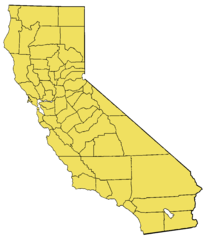
Резюме
- Based on the modified Commerce Dept. map used in California.
- For en:wikipedia California county links, see also: en: List of California counties.
- Maps by county links
-
- The following maps are scaled down to 200x231, with individual county's highlight layers made visible:
Alameda | Alpine | Amador | Butte | Calaveras | Colusa | Contra Costa | Del Norte | El Dorado | Fresno | Glenn | Humboldt | Imperial | Inyo | Kern | Kings | Lake | Lassen | Los Angeles | Madera | Marin | Mariposa | Mendocino | Merced | Modoc | Mono | Monterey | Napa | Nevada | Orange | Placer | Plumas | Riverside | Sacramento | San Benito | San Bernardino | San Diego | San Francisco | San Joaquin | San Luis Obispo | San Mateo | Santa Barbara | Santa Clara | Santa Cruz | Shasta | Sierra | Siskiyou | Solano | Sonoma | Stanislaus | Sutter | Tehama | Trinity | Tulare | Tuolumne | Ventura | Yolo | Yuba
Source
Uncompressed version of w:File:California map showing counties (source).xcf.gz (gzipped images are not permitted for upload anymore).
Лицензиране
This file created by me, w:User:Brion VIBBER, based on the above-referenced file uploaded to meta.wikipedia.org a long time ago (old upload system from 2001/2002). That file claims to be a product of the US Department of Commerce, and should be public domain as a US government product. I claim no additional copyright on the modified image. --Brion 01:06, 14 January 2006 (UTC)
Този материал е обществено достояние в Съединените Щати тъй като е дело на Федералното правителство на САЩ.
Забележка: Това не се отнася за материали, създадени от щатски правителства или местни органи на властта..
|
 | |
| This file has been identified as being free of known restrictions under copyright law, including all related and neighboring rights. | ||
Original Wikipedia upload log
- 06:36, 9 September 2002 (84 KB) w:User:Brion VIBBER (Base image for the California county maps (GIMP image))
|
|
История на файла
Избирането на дата/час ще покаже как е изглеждал файлът към онзи момент.
| Дата/Час | Миникартинка | Размер | Потребител | Коментар | |
|---|---|---|---|---|---|
| текуща | 22:45, 15 февруари 2009 |  | 957 × 1107 (363 КБ) | Papa November | == Summary == Base image for the California county maps (GIMP image). Based on the [http://meta.wikipedia.com/upload/California_Map.jpg modified Commerce Dept map] used in California. The following maps are scaled |
Използване на файла
Няма страници, използващи файла.