
Файл:BorahPeakID.jpg
Размер на този преглед: 800 × 441 пиксела. Други разделителни способности: 320 × 176 пиксела | 640 × 353 пиксела.
Оригинален файл (1089 × 600 пиксела, големина на файла: 125 КБ, MIME-тип: image/jpeg)
| Този файл е от Общомедия и може да се използва от други проекти.
Следва информация за файла, достъпна през оригиналната му описателна страница. |
Резюме
| Описание |
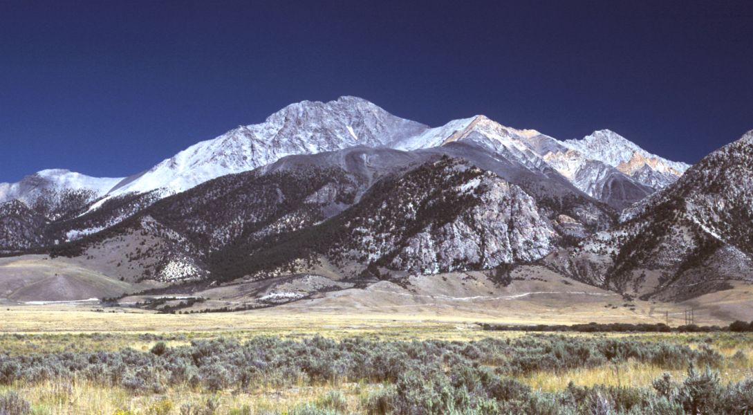
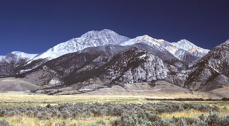
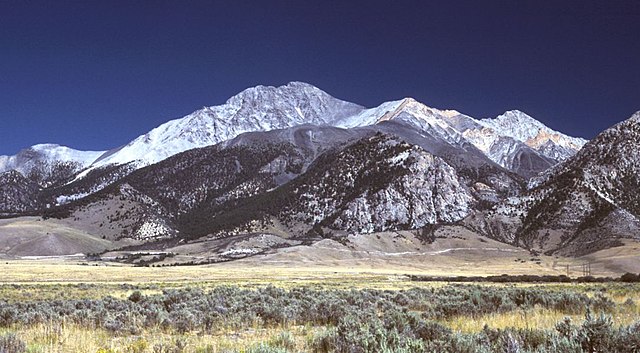
English: Borah Peak, Idaho, looking east. The normal climbing route begins in the wooded canyon at center left. The white line running along the base of the peak is the fault trace from the 1983 earthquake. |
| Дата | 6 май 2006 (original upload date) |
| Източник | Прехвърлен от en.wikipedia към Общомедия от RedWolf използвайки CommonsHelper. |
| Автор | G. Thomas at английски Уикипедия |
Лицензиране
| Тази творба е публикувана от своя автор, G. Thomas at английски Уикипедия, като обществено достояние. Това разрешение е в сила за целия свят. В някои държави това може да не е възможно от законодателна гледна точка; затова: G. Thomas дава на всекиго правото да използва тази творба за всякакви цели, без никакви условия, освен ако такива условия съществуват по закон. |
Дневник на оригиналното качване
The original description page was here. All following user names refer to en.wikipedia.
- 2006-05-06 20:17 G. Thomas 1089×600× (127941 bytes) Borah Peak, Idaho, looking east. The normal climbing route begins in the wooded canyon at center left. The white line running along the base of the peak is the fault trace from the 1983 earthquake.
История на файла
Избирането на дата/час ще покаже как е изглеждал файлът към онзи момент.
| Дата/Час | Миникартинка | Размер | Потребител | Коментар | |
|---|---|---|---|---|---|
| текуща | 16:15, 21 февруари 2009 | | 1089 × 600 (125 КБ) | RedWolf | {{Information |Description={{en|Borah Peak, Idaho, looking east. The normal climbing route begins in the wooded canyon at center left. The white line running along the base of the peak is the fault trace from the 1983 earthquake.}} |Source=Transferred f |
Използване на файла
Следната страница използва следния файл:
Глобално използване на файл
Този файл се използва от следните други уикита:
- Употреба в cs.wikipedia.org
- Употреба в en.wikipedia.org
- List of mountains of the United States
- Borah Peak
- List of U.S. states and territories by elevation
- Lost River Range
- List of the most isolated major summits of the United States
- List of ultras of North America
- List of the most prominent summits of the United States
- List of the major 100-kilometer summits of North America
- Mountain states
- List of the highest major summits of North America
- List of the major 3000-meter summits of the Rocky Mountains
- List of the highest major summits of the United States
- Употреба в es.wikipedia.org
- Употреба в it.wikipedia.org
- Употреба в it.wikivoyage.org
- Употреба в nl.wikipedia.org
- Употреба в pt.wikipedia.org
- Употреба в ru.wikipedia.org
- Употреба в simple.wikipedia.org
- Употреба в uk.wikipedia.org