
Файл:Kiplingsindia.jpg

Оригинален файл (802 × 663 пиксела, големина на файла: 114 КБ, MIME-тип: image/jpeg)
| Този файл е от Общомедия и може да се използва от други проекти.
Следва информация за файла, достъпна през оригиналната му описателна страница. |
Резюме
| Описание |
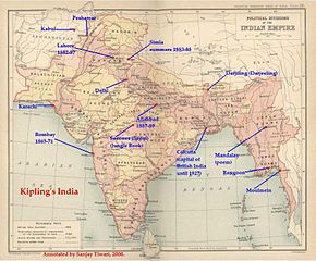
РезюмеThis is a low-resolution (40% of original) scanned image of the map, "Politial Divisions of the Indian Empire" from the Imperial Gazeteer of India (volume 26, Atlas), published by the Oxford University Press, 1909. The map image was scanned and then annotated by me (Sanjay Tiwari 18:24, 30 September 2006 (UTC)) |
||||||
| Източник | Собствена творба | ||||||
| Автор | User Sanjay Tiwari on en.wikipedia | ||||||
| Права (Повторно използване на файла) |
|
||||||
| други версии |
Originally from en.wikipedia; description page is (was) here * 18:24, 30 September 2006 [[:en:User:Sanjay Tiwari|Sanjay Tiwari]] 880×680 (126,459 bytes) <span class="comment">(This is a low-resolution (40% of original) scanned image of the map, "Politial Divisions of the Indian Empire" from the ''Imperial Gazeteer of India'' (volume 26, Atlas), published by the Oxford University Press, 1909. The map image was scanned and the)</span> |
||||||
(Uploaded using CommonsHelper or PushForCommons)
Лицензиране
|
Това произведение е обществено достояние в държавите, в които срокът на авторското право е 70 години или по-малко след смъртта на автора.
| |
| This file has been identified as being free of known restrictions under copyright law, including all related and neighboring rights. | |
Дневник на оригиналното качване
- 2007-05-14 07:25 Kintetsubuffalo 802×663× (117058 bytes) trimmed to make edges equal
- 2006-09-30 18:24 Sanjay Tiwari 880×680× (126459 bytes) This is a low-resolution (40% of original) scanned image of the map, "Politial Divisions of the Indian Empire" from the ''Imperial Gazeteer of India'' (volume 26, Atlas), published by the Oxford University Press, 1909. The map image was scanned and the
История на файла
Избирането на дата/час ще покаже как е изглеждал файлът към онзи момент.
| Дата/Час | Миникартинка | Размер | Потребител | Коментар | |
|---|---|---|---|---|---|
| текуща | 13:39, 28 март 2016 | | 802 × 663 (114 КБ) | OgreBot | (BOT): Uploading old version of file from en.wikipedia; originally uploaded on 2007-05-14 07:25:05 by Kintetsubuffalo |
| 13:39, 28 март 2016 |  | 880 × 680 (123 КБ) | OgreBot | (BOT): Uploading old version of file from en.wikipedia; originally uploaded on 2006-09-30 18:24:12 by Sanjay Tiwari | |
| 20:17, 13 ноември 2006 |  | 776 × 600 (95 КБ) | Chechof | {{Information| |Description= == Summary == This is a low-resolution (40% of original) scanned image of the map, "Politial Divisions of the Indian Empire" from the ''Imperial Gazeteer of India'' (volume 26, Atlas), published by the Oxford University Press |
Използване на файла
Няма страници, използващи файла.
Глобално използване на файл
Този файл се използва от следните други уикита:
- Употреба в ca.wikipedia.org
- Употреба в el.wikipedia.org
- Употреба в en.wikipedia.org
- Употреба в es.wikipedia.org
- Употреба в gl.wikipedia.org
- Употреба в hi.wikipedia.org
- Употреба в hu.wikipedia.org
- Употреба в ja.wikipedia.org
- Употреба в pt.wikipedia.org
- Употреба в tt.wikipedia.org
- Употреба в vi.wikipedia.org