
Файл:Provinces of Cameroon numbered.svg

Оригинален файл (Файл във формат SVG, основен размер: 586 × 769 пиксела, големина на файла: 1,22 МБ)
| Този файл е от Общомедия и може да се използва от други проекти.
Следва информация за файла, достъпна през оригиналната му описателна страница. |
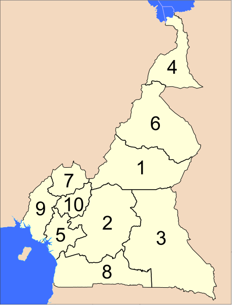
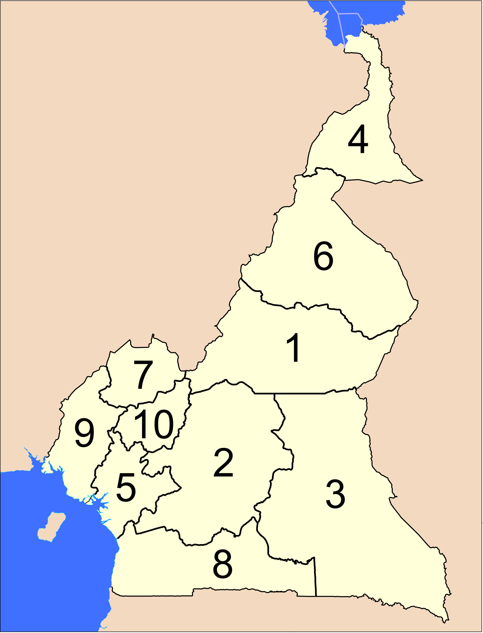
The provinces of Cameroon.
Modified from http://www.un.org/Depts/Cartographic/map/profile/cameroon.pdf
| This image is a map derived from a United Nations map.
Unless stated otherwise, UN maps are to be considered in the public domain. This applies worldwide. UN maps are, in principle, open source material and you can use them in your work or for making your own map. UN requests however that you delete the UN name, logo and reference number upon any modification to the map. Content of your map will be your responsibility. You can state in your publication, if you wish, something like: based on UN map … (map name, map number, revision number and date). See: Geospatial Information Section. And: Geospatial, location data for a better world. |
 |
История на файла
Избирането на дата/час ще покаже как е изглеждал файлът към онзи момент.
| Дата/Час | Миникартинка | Размер | Потребител | Коментар | |
|---|---|---|---|---|---|
| текуща | 04:39, 10 април 2007 | | 586 × 769 (1,22 МБ) | Interiot~commonswiki | The provinces of Cameroon. Modified from http://www.un.org/Depts/Cartographic/map/profile/cameroon.pdf {{UN map}} Category:SVG maps of Africa |
Използване на файла
Следните 3 страници използват следния файл:
Глобално използване на файл
Този файл се използва от следните други уикита:
- Употреба в ab.wikipedia.org
- Употреба в ar.wikipedia.org
- Употреба в bcl.wikipedia.org
- Употреба в be-tarask.wikipedia.org
- Употреба в be.wikipedia.org
- Употреба в ca.wikipedia.org
- Употреба в cs.wikipedia.org
- Употреба в de.wikipedia.org
- Употреба в en.wikipedia.org
- Употреба в es.wikipedia.org
- Употреба в eu.wikipedia.org
- Употреба в fa.wikipedia.org
- Употреба в fi.wikipedia.org
- Употреба в guw.wikipedia.org
- Употреба в hr.wikipedia.org
- Употреба в id.wikipedia.org
- Употреба в ja.wikipedia.org
- Употреба в ka.wikipedia.org
- Употреба в ko.wikipedia.org
- Употреба в li.wikipedia.org
- Употреба в lt.wikipedia.org
- Употреба в mk.wikipedia.org
- Употреба в mt.wikipedia.org
- Употреба в nl.wikipedia.org
- Употреба в no.wikipedia.org
- Употреба в pt.wikipedia.org
- Употреба в ru.wikipedia.org
- Употреба в sco.wikipedia.org
- Употреба в simple.wikipedia.org
- Употреба в si.wikipedia.org
- Употреба в sr.wikipedia.org
- Употреба в sv.wikipedia.org
- Употреба в tr.wikipedia.org
- Употреба в uk.wikipedia.org
- Употреба в ur.wikipedia.org
- Употреба в zh-min-nan.wikipedia.org
- Употреба в zh.wikipedia.org