
Файл:IssaouaneErg Algeria ISS010-E-13539.jpg
Оригинален файл (1000 × 662 пиксела, големина на файла: 491 КБ, MIME-тип: image/jpeg)
| Този файл е от Общомедия и може да се използва от други проекти.
Следва информация за файла, достъпна през оригиналната му описателна страница. |
Резюме
| Описание |
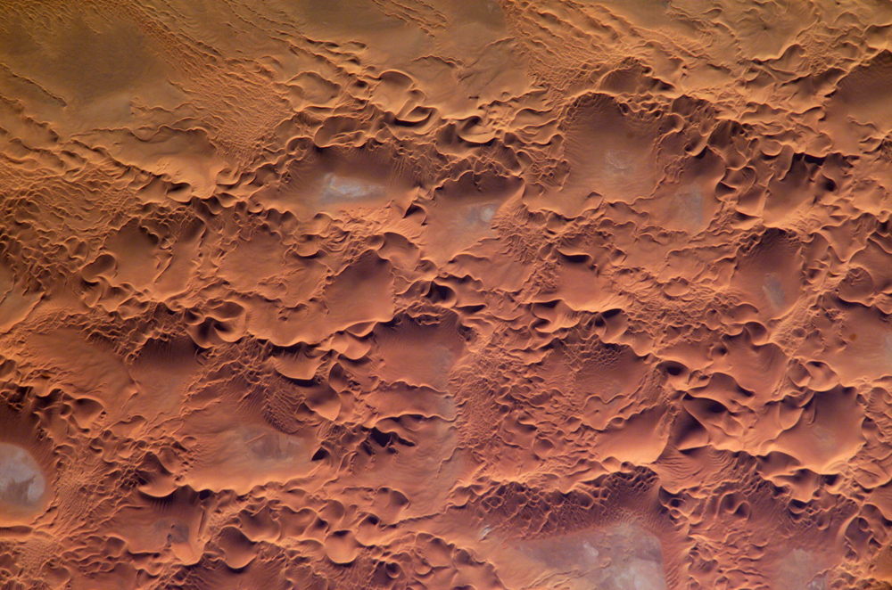
English: Astronaut photo of the Issaouane Erg (Sahara Desert), Algeria.
|
||||||||||||||||||||||||||||||||||||||||||||||||||||||
| Дата | |||||||||||||||||||||||||||||||||||||||||||||||||||||||
| Източник | http://earthobservatory.nasa.gov/Newsroom/NewImages/images.php3?img_id=16813 | ||||||||||||||||||||||||||||||||||||||||||||||||||||||
| Автор | ISS Crew Earth Observations experiment and the Image Science & Analysis Group, Johnson Space Center. | ||||||||||||||||||||||||||||||||||||||||||||||||||||||
| Права (Повторно използване на файла) |
NASA, public domain | ||||||||||||||||||||||||||||||||||||||||||||||||||||||
Лицензиране
This file is in the public domain in the United States because it was created by the Image Science & Analysis Laboratory, of the NASA Johnson Space Center. NASA copyright policy states that "NASA material is not protected by copyright unless noted". (NASA media use guidelines or Conditions of Use of Astronaut Photographs).
Photo source: ISS010-E-13539.
|
История на файла
Избирането на дата/час ще покаже как е изглеждал файлът към онзи момент.
| Дата/Час | Миникартинка | Размер | Потребител | Коментар | |
|---|---|---|---|---|---|
| текуща | 17:58, 18 май 2006 | | 1000 × 662 (491 КБ) | Holly Cheng | ==Summary== {{Information | Description=Astronaut photo of the Issaouane Erg (Sahara Desert), Algeria. | Source=http://earthobservatory.nasa.gov/Newsroom/NewImages/images.php3?img_id=16813 | Date=January 16, 2005 | Author=ISS Crew Earth Observations exper |
Използване на файла
Следната страница използва следния файл:
Глобално използване на файл
Този файл се използва от следните други уикита:
- Употреба в ar.wikipedia.org
- Употреба в ba.wikipedia.org
- Употреба в be.wikipedia.org
- Употреба в br.wikipedia.org
- Употреба в ceb.wikipedia.org
- Употреба в da.wikipedia.org
- Употреба в de.wikipedia.org
- Употреба в en.wikipedia.org
- Употреба в eo.wikipedia.org
- Употреба в fi.wikipedia.org
- Употреба в fr.wikipedia.org
- Употреба в fr.wiktionary.org
- Употреба в hi.wikipedia.org
- Употреба в it.wikipedia.org
- Употреба в it.wikibooks.org
- Употреба в ka.wikipedia.org
- Употреба в lt.wikipedia.org
- Употреба в mhr.wikipedia.org
- Употреба в mk.wikipedia.org
- Употреба в nn.wikipedia.org
- Употреба в pl.wikipedia.org
- Употреба в pl.wiktionary.org
- Употреба в ro.wikipedia.org
- Употреба в ru.wikipedia.org
- Употреба в sl.wikipedia.org
- Употреба в sr.wikipedia.org
- Употреба в sv.wikipedia.org
- Употреба в sv.wiktionary.org
- Употреба в uk.wikipedia.org
- Употреба в uz.wikipedia.org
- Употреба в vi.wikipedia.org
- Употреба в www.wikidata.org