
Файл:Simeon DeWitt Central NY Military Tract c.1792.png
Оригинален файл (1137 × 1384 пиксела, големина на файла: 1,76 МБ, MIME-тип: image/png)
| Този файл е от Общомедия и може да се използва от други проекти.
Следва информация за файла, достъпна през оригиналната му описателна страница. |
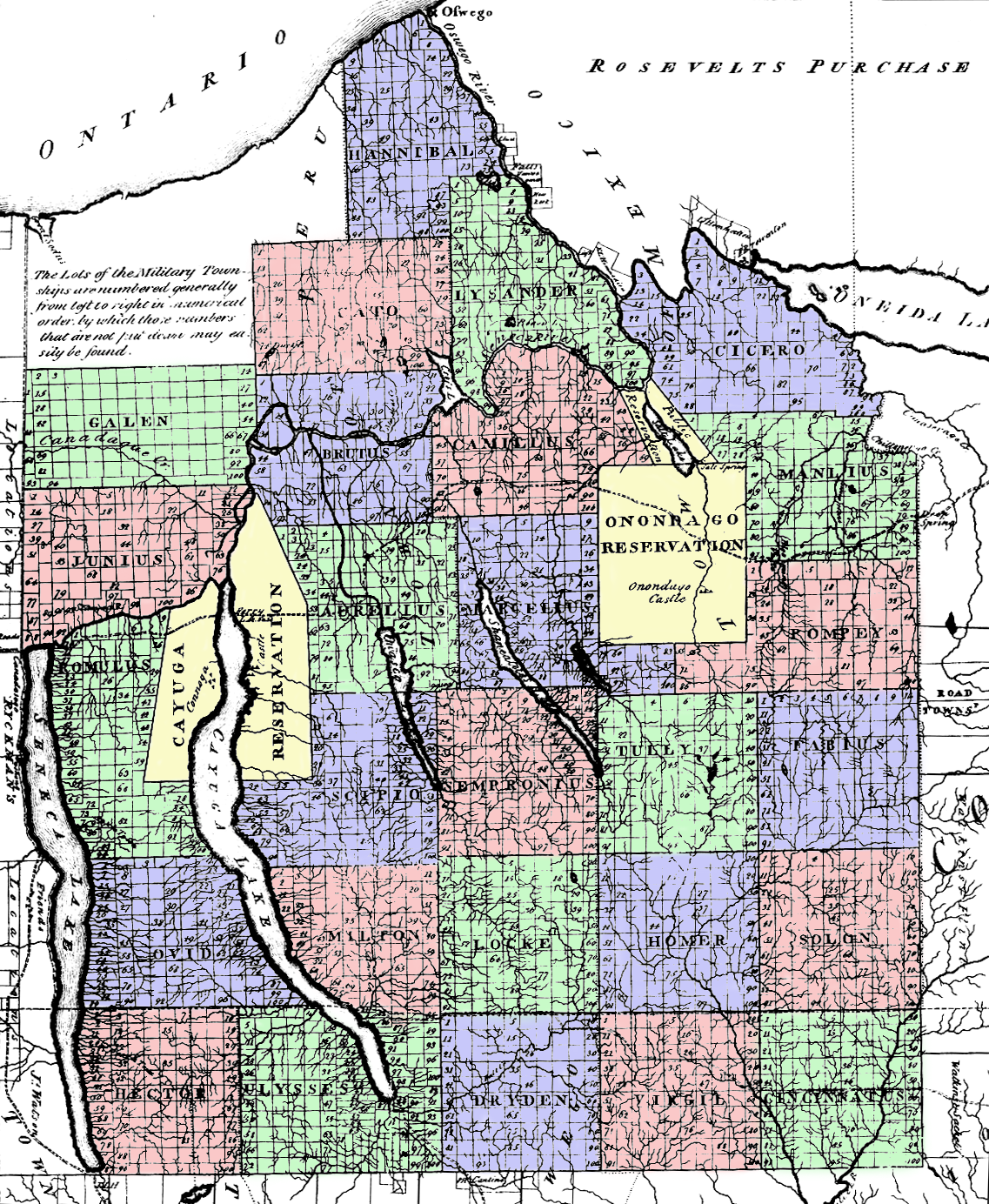
Резюме
Central New York Military Tract map drawn by Simeon De Witt, 1792 or 1793, and colored by me. The townships were at first numbered (1 through 28), but were later given classical Greek and Roman names:
|
1. Lysander |
8. Aurelius |
15. Fabius |
22. Ulysses |
A lower resolution version of this map is: Image:CNY Military Tract.png.
Лицензиране
|
Това произведение е обществено достояние в държавите, в които срокът на авторското право е 70 години или по-малко след смъртта на автора.
| |
| This file has been identified as being free of known restrictions under copyright law, including all related and neighboring rights. | |
История на файла
Избирането на дата/час ще покаже как е изглеждал файлът към онзи момент.
| Дата/Час | Миникартинка | Размер | Потребител | Коментар | |
|---|---|---|---|---|---|
| текуща | 21:08, 18 юни 2006 | | 1137 × 1384 (1,76 МБ) | Nonenmac | Central New York Military Tract map drawn by Simeon DeWitt, 1792 or 1793. The townships were at first numbered (1 through 28), but were later given classical Greek and Roman names: {| | width="150"| 1. |
Използване на файла
Следната страница използва следния файл:
Глобално използване на файл
Този файл се използва от следните други уикита:
- Употреба в ar.wikipedia.org
- Употреба в en.wikipedia.org
- Употреба в pt.wikipedia.org