
Файл:1870 Index Chart to GTS India-1.jpg
Размер на този преглед: 625 × 599 пиксела. Други разделителни способности: 250 × 240 пиксела | 501 × 480 пиксела | 801 × 768 пиксела | 1068 × 1024 пиксела | 2136 × 2048 пиксела | 7308 × 7006 пиксела.
Оригинален файл (7308 × 7006 пиксела, големина на файла: 25,55 МБ, MIME-тип: image/jpeg)
| Този файл е от Общомедия и може да се използва от други проекти.
Следва информация за файла, достъпна през оригиналната му описателна страница. |
Резюме
Лицензиране
This media file is in the public domain in the United States. This applies to U.S. works where the copyright has expired, often because its first publication occurred prior to January 1, 1929, and if not then due to lack of notice or renewal. See this page for further explanation.
|
 | |
 |
This image might not be in the public domain outside of the United States; this especially applies in the countries and areas that do not apply the rule of the shorter term for US works, such as Canada, Mainland China (not Hong Kong or Macao), Germany, Mexico, and Switzerland. The creator and year of publication are essential information and must be provided. See Wikipedia:Public domain and Wikipedia:Copyrights for more details.
|
История на файла
Избирането на дата/час ще покаже как е изглеждал файлът към онзи момент.
| Дата/Час | Миникартинка | Размер | Потребител | Коментар | |
|---|---|---|---|---|---|
| текуща | 12:37, 6 август 2014 | | 7308 × 7006 (25,55 МБ) | Shyamal | clean |
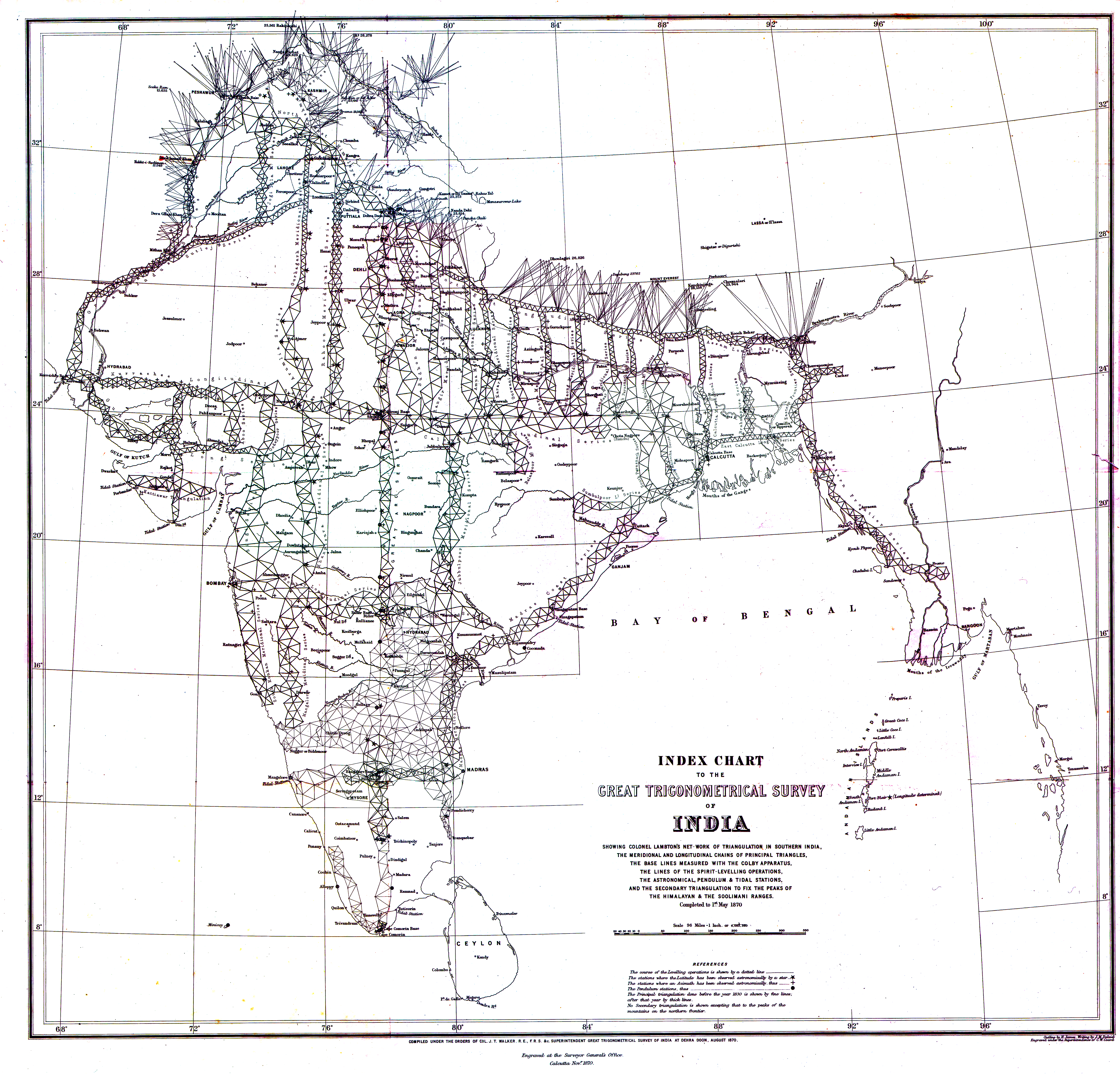
| 00:22, 5 септември 2013 |  | 7308 × 7006 (3,52 МБ) | SanderO | {{Information |Description ={{en|1=1870 Index Chart of the Great Trigonometric Survey of India}} {{nl|1=1870 kaart van de Grote Trigonometrische Kartering van India}} |Source =Survey of India |Author =Survey of India |Date ... |
Използване на файла
Следната страница използва следния файл:
Глобално използване на файл
Този файл се използва от следните други уикита:
- Употреба в ca.wikipedia.org
- Употреба в da.wikipedia.org
- Употреба в de.wikipedia.org
- Употреба в el.wikipedia.org
- Употреба в en.wikipedia.org
- Употреба в es.wikipedia.org
- Употреба в eu.wikipedia.org
- Употреба в hi.wikipedia.org
- Употреба в id.wikipedia.org
- Употреба в it.wikipedia.org
- Употреба в ja.wikipedia.org
- Употреба в kn.wikipedia.org
- Употреба в la.wikipedia.org
- Употреба в mk.wikipedia.org
- Употреба в mt.wikipedia.org
- Употреба в nl.wikipedia.org
- Употреба в pt.wikipedia.org
- Употреба в ro.wikipedia.org
- Употреба в ru.wikipedia.org
- Употреба в sr.wikipedia.org
- Употреба в te.wikipedia.org
- Употреба в uk.wikipedia.org
- Употреба в www.wikidata.org
- Употреба в zh.wikipedia.org