
Файл:BlankMap-World-Flattened.svg

Размер на този PNG предварителен преглед на изходния SVG файл: 800 × 406 пиксела. Други разделителни способности: 320 × 162 пиксела | 640 × 325 пиксела | 1024 × 519 пиксела | 1280 × 649 пиксела | 2560 × 1299 пиксела | 2754 × 1397 пиксела.
Оригинален файл (Файл във формат SVG, основен размер: 2754 × 1397 пиксела, големина на файла: 1,68 МБ)
| Този файл е от Общомедия и може да се използва от други проекти.
Следва информация за файла, достъпна през оригиналната му описателна страница. |
Резюме
| Описание |
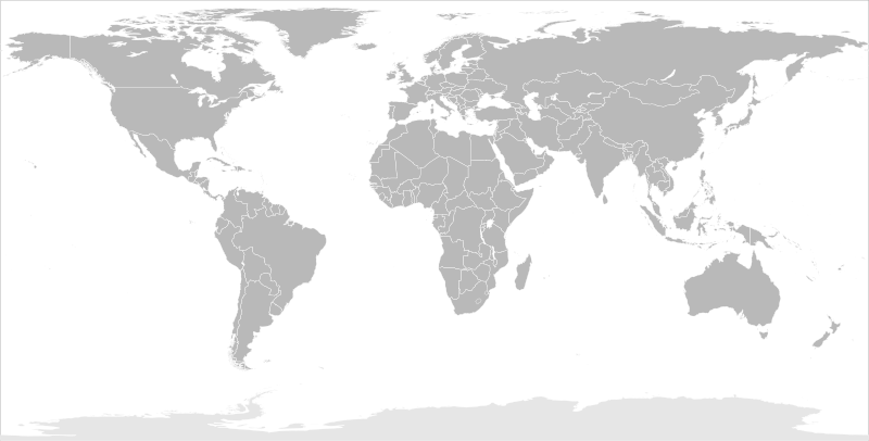
English: Blank political map of the world in modified (flattened) Robinson projection. This image is a sample of output from nugsl-worldmap, a Python script for the manipulation of this map. The script can also produce rotated images, add pinpoint marks at particular geographic coordinates, and produce web pages with clickable areas for specific countries and pinpoint marks.
Note that this map is not equirectangular, and cannot be used as a push-pin map to identify coordinates assuming equal latitude and longitude spacing. A map using the equirectangular projection is available at File:BlankMap-World6-Equirectangular.svg. |
| Дата | (for the script only) |
| Източник |
http://www.law.nagoya-u.ac.jp/en/appendix/software/worldmap/ Refactored from Image:BlankMap-World.svg, q.v. |
| Автор | Frank Bennett |
| Права (Повторно използване на файла) |
The map data manipulated by the script is in the public domain. The raw output of the script, including the file shown here, is also in the public domain. |
| други версии |
Derivative works of this file:
|
| SVG развитие |
Лицензиране
| Аз, носителят на авторските права над тази творба, я публикувам като обществено достояние. Това разрешение е в сила за целия свят. В някои държави това може да не е възможно от законодателна гледна точка; затова: Давам на всекиго правото да използва тази творба за всякакви цели, без никакви условия, освен ако такива условия съществуват по закон. |
История на файла
Избирането на дата/час ще покаже как е изглеждал файлът към онзи момент.
| Дата/Час | Миникартинка | Размер | Потребител | Коментар | |
|---|---|---|---|---|---|
| текуща | 10:44, 20 март 2014 | | 2754 × 1397 (1,68 МБ) | Underlying lk | fix classes for Soudan and South Soudan |
| 16:01, 16 март 2013 |  | 2754 × 1397 (1,68 МБ) | Flappiefh | South Sudan added. | |
| 11:47, 14 януари 2008 |  | 2754 × 1397 (1,67 МБ) | Biercenator | Updated to current version of map produced by the script. | |
| 13:22, 19 декември 2007 |  | 940 × 477 (1,99 МБ) | Biercenator | == Summary == Refactored from en:Image:BlankMap-World6.svg, q.v. This image is a sample of output from [http://gsl-nagoya-u.net/appendix/software/worldmap/ nugsl-worldmap], a Python script for the manipulation and maintenance of this map. The flatt | |
| 15:31, 15 декември 2007 |  | 940 × 477 (2 МБ) | Biercenator | Refactored from en:Image:BlankMap-World6.svg, q.v. This image might prove useful if you want to change the area shown in the center of the Robinson projection version, since the conversion can be reversed. | |
| 15:18, 15 декември 2007 |  | 940 × 477 (2 МБ) | Biercenator | == Summary == Refactored from en:BlankMap-World6.svg, q.v. This image might prove useful if you want to area shown in the center of the Robinson projection version, since the conversion can be reversed. |
Използване на файла
Няма страници, използващи файла.
Глобално използване на файл
Този файл се използва от следните други уикита:
- Употреба в ca.wikipedia.org
- Употреба в de.wikipedia.org
- Употреба в en.wikipedia.org
- Употреба в es.wikipedia.org
- Употреба в fr.wikipedia.org
- Употреба в he.wikipedia.org