
Файл:Forum-Romanum-Platner.jpg
Оригинален файл (1400 × 1037 пиксела, големина на файла: 657 КБ, MIME-тип: image/jpeg)
| Този файл е от Общомедия и може да се използва от други проекти.
Следва информация за файла, достъпна през оригиналната му описателна страница. |
Резюме
| Описание |
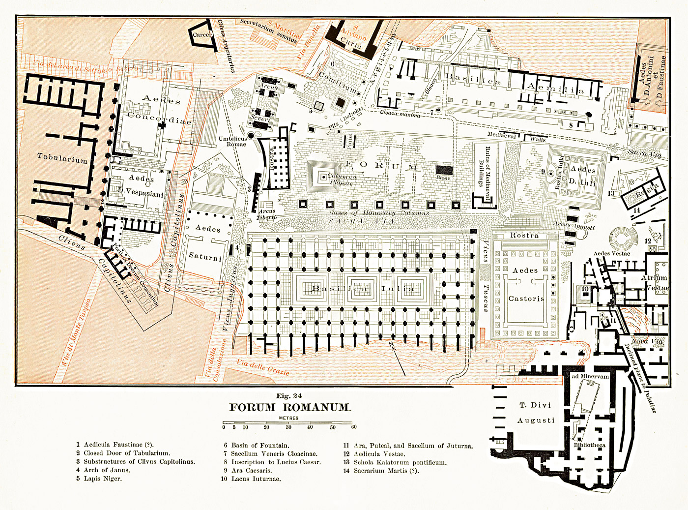
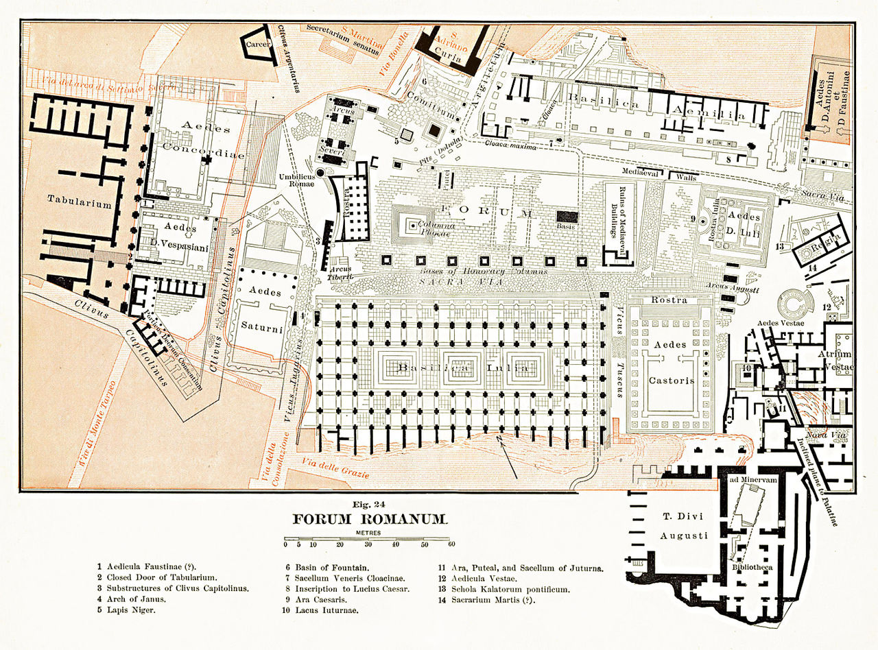
English: Map of the Roman Forum area. The scan from the original book was edited and corrected.
Français : Carte de la zone du Forum Romain à Rome (Latium, Italie).
Italiano: Pianta archeologica del Foro Romano, modificata da una scansione su due pagine del libro "The Topography and Monuments of Ancient Rome" di Ball Platner edito nel 1904. |
| Дата | |
| Източник | Samuel Ball Platner's The Topography and Monuments of Ancient Rome (1904) |
| Автор | saikindi |
Лицензиране
|
Това произведение е обществено достояние в държавите, в които срокът на авторското право е 70 години или по-малко след смъртта на автора.
| |
| This file has been identified as being free of known restrictions under copyright law, including all related and neighboring rights. | |
История на файла
Избирането на дата/час ще покаже как е изглеждал файлът към онзи момент.
| Дата/Час | Миникартинка | Размер | Потребител | Коментар | |
|---|---|---|---|---|---|
| текуща | 15:45, 17 септември 2009 | | 1400 × 1037 (657 КБ) | Saikindi | {{Information |Description={{en|1=Map of the Roman Forum area. The scan from the original book was edited and corrected.}} {{it|1=Pianta archeologica del Foro Romano, modificata da una scansione su due pagine del libro "The Topography and Monuments of Anc |
Използване на файла
Следната страница използва следния файл:
Глобално използване на файл
Този файл се използва от следните други уикита:
- Употреба в cs.wikipedia.org
- Употреба в el.wikipedia.org
- Употреба в fr.wikipedia.org
- Употреба в it.wikipedia.org
- Употреба в ja.wikipedia.org
- Употреба в ru.wikipedia.org