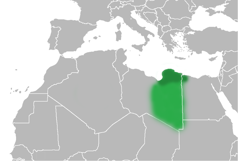
Файл:Map of Cyrenaica.png

Размер на този преглед: 800 × 543 пиксела. Други разделителни способности: 320 × 217 пиксела | 640 × 434 пиксела | 918 × 623 пиксела.
Оригинален файл (918 × 623 пиксела, големина на файла: 92 КБ, MIME-тип: image/png)
История на файла
Избирането на дата/час ще покаже как е изглеждал файлът към онзи момент.
| Дата/Час | Миникартинка | Размер | Потребител | Коментар | |
|---|---|---|---|---|---|
| текуща | 20:51, 1 юли 2010 |  | 918 × 623 (92 КБ) | Felitsata | change of border |
| 20:33, 1 юли 2010 |  | 918 × 623 (93 КБ) | Felitsata | {{Information |Description={{en|1="United States of North Africa" (proposal by President [http://en.wikipedia.org/wiki/Habib_Bourguiba Habib Bourguiba] for Tunisia, Algeria and Libya 1973) and "Arab Islamic Republic" (proposal by [http://en.wikipedia.org/ |
Използване на файла
Следната страница използва следния файл:
Глобално използване на файл
Този файл се използва от следните други уикита:
- Употреба в bn.wikipedia.org
- Употреба в en.wikipedia.org
- Употреба в es.wikipedia.org
- Употреба в fa.wikipedia.org
- Употреба в fi.wikipedia.org
- Употреба в he.wikipedia.org
- Употреба в hr.wikipedia.org
- Употреба в hy.wikipedia.org
- Употреба в inh.wikipedia.org
- Употреба в it.wikipedia.org
- Употреба в ja.wikipedia.org
- Употреба в ko.wikipedia.org
- Употреба в la.wiktionary.org
- Употреба в nn.wikipedia.org
- Употреба в pl.wiktionary.org
- Употреба в ro.wikipedia.org
- Употреба в ru.wikipedia.org
- Употреба в sh.wikipedia.org
- Употреба в sl.wikipedia.org
- Употреба в sr.wikipedia.org
- Употреба в th.wikipedia.org
- Употреба в tr.wikipedia.org
- Употреба в uk.wikipedia.org


