
Файл:Constantinople conference west.jpg
Оригинален файл (2000 × 3804 пиксела, големина на файла: 1,88 МБ, MIME-тип: image/jpeg)
| Този файл е от Общомедия и може да се използва от други проекти.
Следва информация за файла, достъпна през оригиналната му описателна страница. |
Резюме
| Описание |
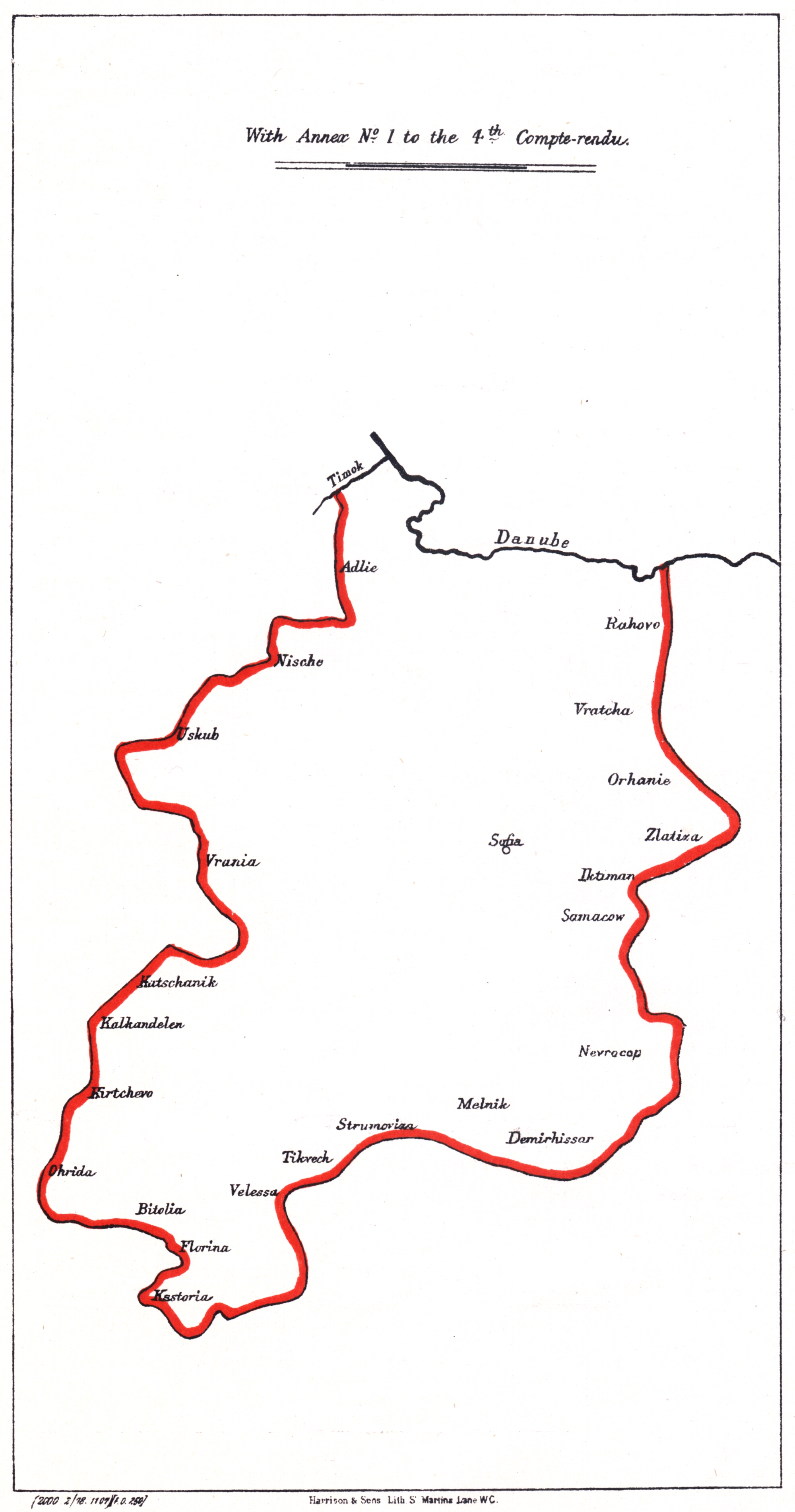
Български: Карта на Западата българска автономна област, предложена от Цариградската конференция в 1876
English: Map of the Western Bulgarian Autonomous province, proposed by the en:Constantinople Conference (1876) |
| Дата | |
| Източник |
Български: Синя книга 13, По-нататъшна кореспонденция по турските проблеми (С карти на предложените български вилаети
English: Blue book 13 "Further Correspondence respecting the affairs of Turkey. (With Maps of proposed Bulgarian Vilayets) |
| Автор |
Лицензиране
|
Това произведение е обществено достояние в държавите, в които срокът на авторското право е 70 години или по-малко след смъртта на автора.
| |
| This file has been identified as being free of known restrictions under copyright law, including all related and neighboring rights. | |
История на файла
Избирането на дата/час ще покаже как е изглеждал файлът към онзи момент.
| Дата/Час | Миникартинка | Размер | Потребител | Коментар | |
|---|---|---|---|---|---|
| текуща | 07:58, 1 юни 2008 | | 2000 × 3804 (1,88 МБ) | Alexandar.R.~commonswiki | |
| 19:15, 31 май 2007 |  | 1526 × 2906 (213 КБ) | Мико | {{Information |Description=Map of the proposed Western Bulgarian Autonomous province, proposed by the Constantinople Conference |Source= |Date= |Author= |Permission= |other_versions= }} Category:Maps showing 19th-century history [[Category:Maps of Bul |
Използване на файла
Следните 3 страници използват следния файл:
Глобално използване на файл
Този файл се използва от следните други уикита:
- Употреба в de.wikipedia.org
- Употреба в en.wikipedia.org
- Употреба в ro.wikipedia.org
- Употреба в ru.wikipedia.org
- Употреба в simple.wikipedia.org
- Употреба в tr.wikipedia.org