
Файл:County of Hoorne.png
County_of_Hoorne.png (332 × 318 пиксела, големина на файла: 214 КБ, MIME-тип: image/png)
| Този файл е от Общомедия и може да се използва от други проекти.
Следва информация за файла, достъпна през оригиналната му описателна страница. |
Резюме
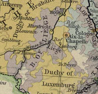
| Описание | Map showing the Prince-Bishopric of Liège and the County of Horne |
| Дата | |
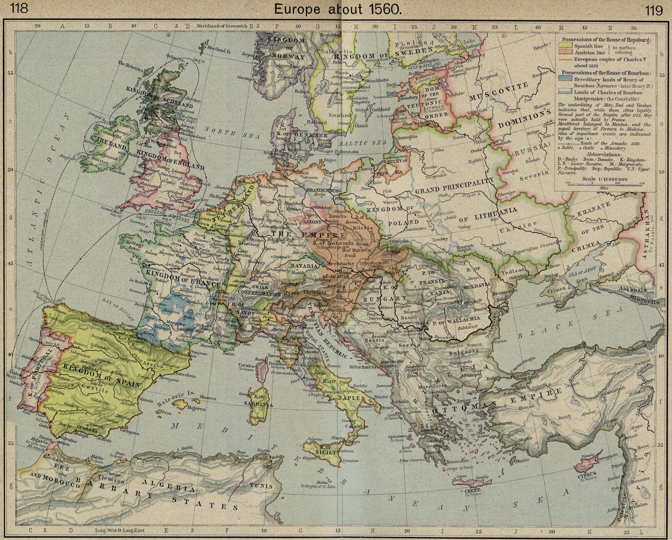
| Източник | Excerpted from Europe about 1560. From The Historical Atlas by William R. Shepherd, 1923 |
| Автор | William R. Shepherd |
Лицензиране
|
Това произведение е обществено достояние в държавите, в които срокът на авторското право е 70 години или по-малко след смъртта на автора.
| |
| This file has been identified as being free of known restrictions under copyright law, including all related and neighboring rights. | |
История на файла
Избирането на дата/час ще покаже как е изглеждал файлът към онзи момент.
| Дата/Час | Миникартинка | Размер | Потребител | Коментар | |
|---|---|---|---|---|---|
| текуща | 22:57, 16 май 2007 | | 332 × 318 (214 КБ) | OwenBlacker | {{Information |Description=Map showing the en:Prince-Bishopric of Liège and the en:County of Horne |Source=Excerpted from [http://www.lib.utexas.edu/maps/historical/shepherd/europe_1560.jpg Europe about 1560. From The Historical Atlas by Will |
Използване на файла
Следната страница използва следния файл:
Глобално използване на файл
Този файл се използва от следните други уикита:
- Употреба в br.wikipedia.org
- Употреба в fr.wikipedia.org
- Употреба в li.wikipedia.org
- Употреба в nl.wikipedia.org
- Употреба в wa.wikipedia.org
- Употреба в www.wikidata.org