
Файл:P-Africa.svg

Размер на този PNG предварителен преглед на изходния SVG файл: 609 × 599 пиксела. Други разделителни способности: 244 × 240 пиксела | 488 × 480 пиксела | 781 × 768 пиксела | 1041 × 1024 пиксела | 2081 × 2048 пиксела | 1123 × 1105 пиксела.
Оригинален файл (Файл във формат SVG, основен размер: 1123 × 1105 пиксела, големина на файла: 336 КБ)
| Този файл е от Общомедия и може да се използва от други проекти.
Следва информация за файла, достъпна през оригиналната му описателна страница. |
Резюме
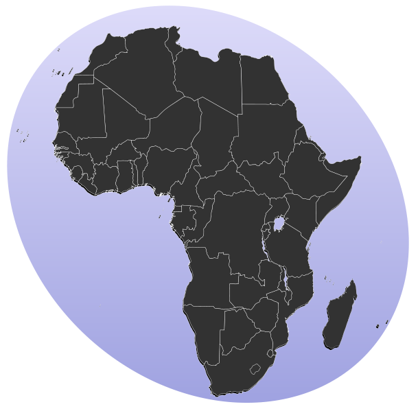
| Описание | Blank map of Africa Detailed SVG map with grouping enabled to connect all non-contiguous parts of a country's territory for easy colouring. Smaller countries can also be represented by larger circles to show their data easier. All countries are tagged by their ISO code. A thorough description of use and other instructions can be found on the instruction page for the World map. The circles used to mark small countries have been reduceed in size compared to BlankMap-World6.svg, also Gambia does not have a circle in this version. For completion, per en:Africa#Territories and regions, Madeira (pt-30), Canary Islands (es-cn), Réunion (re), Mayotte (yt) and Saint Helena (sh) have been added to the map. Ceuta and Melilla were not added since they don't exist in BlankMap-World6.svg. To make these territories transparent simply use the style .sh, .pt-30, .es-cn, .yt, .re {opacity: 0;} | ||
| Дата | (UTC) | ||
| Източник |
This file was derived from: BlankMap-Africa.svg: |
||
| Автор |
|
||
| SVG развитие |
|
Лицензиране
| Тази творба е публикувана от своя автор, Lokal_Profil, като обществено достояние. Това разрешение е в сила за целия свят. В някои държави това може да не е възможно от законодателна гледна точка; затова: |
Дневник на оригиналното качване
This image is a derivative work of the following images:
- File:BlankMap-Africa.svg licensed with PD-user
- 2011-11-08T13:50:11Z Htonl 1000x1000 (188219 Bytes) South Sudan has been allocated ISO code SS; change class and id correspondingly
- 2011-07-09T21:38:33Z Lokal_Profil 1000x1000 (188235 Bytes) Fixed code. Essentialy reverted and readded south sudan manually
- 2011-07-09T17:09:06Z Seb az86556 1000x1000 (189357 Bytes) +South Sudan
- 2010-07-18T16:04:42Z Stephen Morley 1000x1000 (189216 Bytes) Fixed errors that made SVG invalid
- 2009-09-22T16:22:54Z Lokal_Profil 1000x1000 (188987 Bytes) Reverted to version as of 00:54, 3 April 2008; the new map contains none of the iso code and css abilities of the original
- 2009-09-22T15:11:08Z NuclearVacuum 1000x1000 (360040 Bytes) minor change
- 2009-09-22T15:06:20Z NuclearVacuum 1000x1000 (360239 Bytes) Fixed map so it shows surrounding countries as well as making the code valid
- 2008-04-03T00:54:00Z Lokal_Profil 1000x1000 (188987 Bytes) reunion, saint helena, madeira and canary islands (mayotte already in) added for completion
- 2008-04-01T00:21:58Z Lokal_Profil 1000x1000 (185868 Bytes) Made circles smaller, and circular. They were the right size for the world map but to big for the Africa only map
- 2008-03-31T23:55:20Z Lokal_Profil 1000x1000 (185877 Bytes) Removed circle for gambia, not needed for Africa only map
- 2008-03-24T03:09:01Z Lokal_Profil 1000x1000 (186084 Bytes) {{Information |Description=Blank map of Africa Detailed SVG map with grouping enabled to connect all non-contiguous parts of a country's territory for easy colouring. Smaller countries can also be represented by larger circl
Uploaded with derivativeFX
История на файла
Избирането на дата/час ще покаже как е изглеждал файлът към онзи момент.
| Дата/Час | Миникартинка | Размер | Потребител | Коментар | |
|---|---|---|---|---|---|
| текуща | 13:31, 18 януари 2012 | | 1123 × 1105 (336 КБ) | Amirki | סיני |
| 19:22, 17 януари 2012 |  | 1079 × 1068 (337 КБ) | Amirki | . | |
| 19:20, 17 януари 2012 |  | 1000 × 1000 (337 КБ) | Amirki | == {{int:filedesc}} == {{Information |Description=Blank map of Africa Detailed SVG map with grouping enabled to connect all non-contiguous parts of a country's territory for easy colouring. Smaller countries can also be represented by larger circles to s |
Използване на файла
Следните 77 страници използват следния файл:
- Chalo Chatu
- Аксум (държава)
- Ангола
- Арабски халифат
- Архаичен период на Египет
- Архелай (Египет)
- Африка
- Африка: Звездите сигурно са полудели
- Африканска конфедерация по волейбол
- Африкански лешояд
- Африканско първенство по волейбол
- Африканюз
- Ахмаду Ахиджо
- Бенин
- Бушмени
- Велика зелена стена (Африка)
- Гиза (област)
- Датога
- Демократична република Конго
- Драконови планини
- Древен Египет
- Египет
- Едуард Тингатинга
- Елинистически Египет
- Иберо-мавританска култура
- Италианска Източна Африка
- Италианска Северна Африка
- Кабо Верде
- Кампала
- Канарски острови
- Капсийска култура
- Карнак
- Кафър ел-Шейх (област)
- Книга на мъртвите (Древен Египет)
- Конфликт в Конго
- Куш
- Луксор (област)
- Майот
- Мелиля
- Меща-Афалу
- Мозамбик
- Муамар Кадафи
- Навкратис
- Намибия
- Народна република Мозамбик
- Нефертум
- Нигерийска гражданска война
- Нигерия
- Никола Делирадев
- Ново царство
- Нок
- Огун
- Орания
- Праведен халифат
- Принс Нико Мбарга
- Птах
- Пунт
- Реюнион
- Саве
- Сао
- Северен жираф
- Сервал
- Серенгети
- Сеута
- Сехмет
- Сирт
- Сръчен човек
- Танзания
- Тингатинга
- Транссахарски газопровод
- Транссредиземноморски газопровод
- Уади ал Джадид
- Френска Западна Африка
- Хаутенг
- Червено море (област)
- Чиконзеро Чазунгуза
- Шире
Глобално използване на файл
Този файл се използва от следните други уикита:
- Употреба в als.wikipedia.org
- Употреба в be-tarask.wikipedia.org
- Употреба в el.wikipedia.org
- FIBA Africa
- Κατηγορία:Δημογραφία της Αφρικής
- Κατηγορία:Εβραίοι και Ιουδαϊσμός στην Αφρική
- Κατηγορία:Ασιατική διασπορά στην Αφρική
- Κατηγορία:Ευρωπαϊκή διασπορά στην Αφρική
- Κατηγορία:Λευκοί Αφρικανοί
- Κατηγορία:ΛΟΑΤ στην Αφρική
- Κατηγορία:Σεξουαλικότητα στην Αφρική
- Κατηγορία:Φύλο στην Αφρική
- Κατηγορία:Καθολική Εκκλησία στην Αφρική
- Κατηγορία:Αφρικανοί ανά περιοχή
- Κατηγορία:Αφρικανοί ανά θρησκεία
- Γη του Πουντ
- Κατηγορία:Αφρικανική διασπορά στην Ασία
- Κατηγορία:Αφρικανικές διασπορές στην Αφρική
- Κατηγορία:Αφρικανοί ανά εθνοτική ή εθνική καταγωγή
- Κατηγορία:Αφρικανοί μεσανατολικής καταγωγής
- Κατηγορία:Αραβική διασπορά στην Αφρική
- Κατηγορία:Ιστορία της Οθωμανικής Αυτοκρατορίας στην Αφρική
- Κατηγορία:Αφρικανοί ανά εθνικότητα
- Κατηγορία:Αφρικανική διασπορά στην Ευρώπη
- Κατηγορία:Σχέσεις Μοζαμβίκης-Πορτογαλίας
- Κατηγορία:Μοζαμβικανοί ανά εθνική ή εθνική καταγωγή
- Κατηγορία:Ιστορία της Μοζαμβίκης
- Κατηγορία:Πορτογαλική διασπορά στην Αφρική
- Κατηγορία:Πολιτική ιστορία της Αφρικής
- Κατηγορία:Μεταφορικές υποδομές στην Αφρική
- Κατηγορία:Οικίες στην Αφρική
- Κατηγορία:Κατοικίες στην Αφρική
- Κατηγορία:Αξιοθέατα στην Αλγερία
- Κατηγορία:Οικίες στην Αλγερία
- Κατηγορία:Κατοικίες στην Αλγερία
- Κατηγορία:Αεροπορία στην Αφρική
- Κατηγορία:Αεροπορία στην Αφρική ανά χώρα
- Κατηγορία:Αεροπορία στην Αλγερία
- Κατηγορία:Μεταφορές στην Αλγερία
- Κατηγορία:Έργα υποδομής στην Αλγερία
Преглед на глобалната употреба на файла.